

AUF DEM GRUND GEHEN
MASTER THESIS
WS 17/18
In order to clarify these questions, a theoretical analysis defines the connection between infrastructure planning and landscape architecture and shows approaches and potentials. The subsequent analysis examines the Kiel Canal as an infrastructure in its entirety and takes a closer look at its functioning and integration into the surrounding at various levels. A brief insight into the history of the Kiel Canal outlines the idea and dimension of the intervention in the landscape and how the excavations have been dealt with so far. Building on the previous processes for the deepening from Rendsburg to Kiel will be examined in more detail by analysing individual time layers. Subsequently, the methods of soil removal and application used in the current expansion are described. For further consideration of the handling of the excavated material, this soil represent the design material which subsequently will be used to form excavations and fills related to the new design.
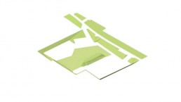
The design will precede a concept that explains the integration of three designs into the region and the canal surroundings. It also shows the functions of the newly created added value of the individual intervention. While presenting the designs, it becomes clear that a comprehensive understanding of infrastructure and its functional structures is necessary to be able to offer adequate solutions for the adjacent areas of infrastructures. Furthermore, it becomes clear that the effects of infrastructures can lead to mutually positively influencing symbioses under the comprehensive consideration of the basic requirements of the locations and demands of the infrastructure on the room. Landscape architecture can, under the condition of opening even more to the topic of infrastructures and establish itself in this technically shaped field, become a competent mediator between the disciplines through its basically interdisciplinary planning culture.
Therefore this master thesis examines the quality of low water levels in Edersee, as its the third largest reservoir in Germany, from a landscape architectural perspective. Strategies are generated on the basis of individual situations at Edersse which can be transferred to the low water levels of other reservoirs. The leading questions are: What different demands do the technical conditions of a dam bring with it? How can one react to different water levels in terms of design? How can the temporarily dry areas be used without affecting the reservoir volume? What special qualities and advantages do low water levels in reservoirs offer? Which new uses can result? The theoretical examination discusses the technical structure of a dam, its functional and social importance and the characteristics of reservoirs as well as a further investigation of selected reservoirs in Germany. These are examined with regard to possible low water levels and the various functions and related conflicts by the respective users.
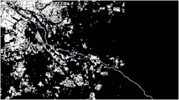
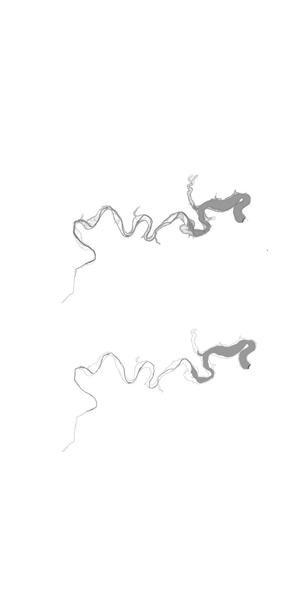
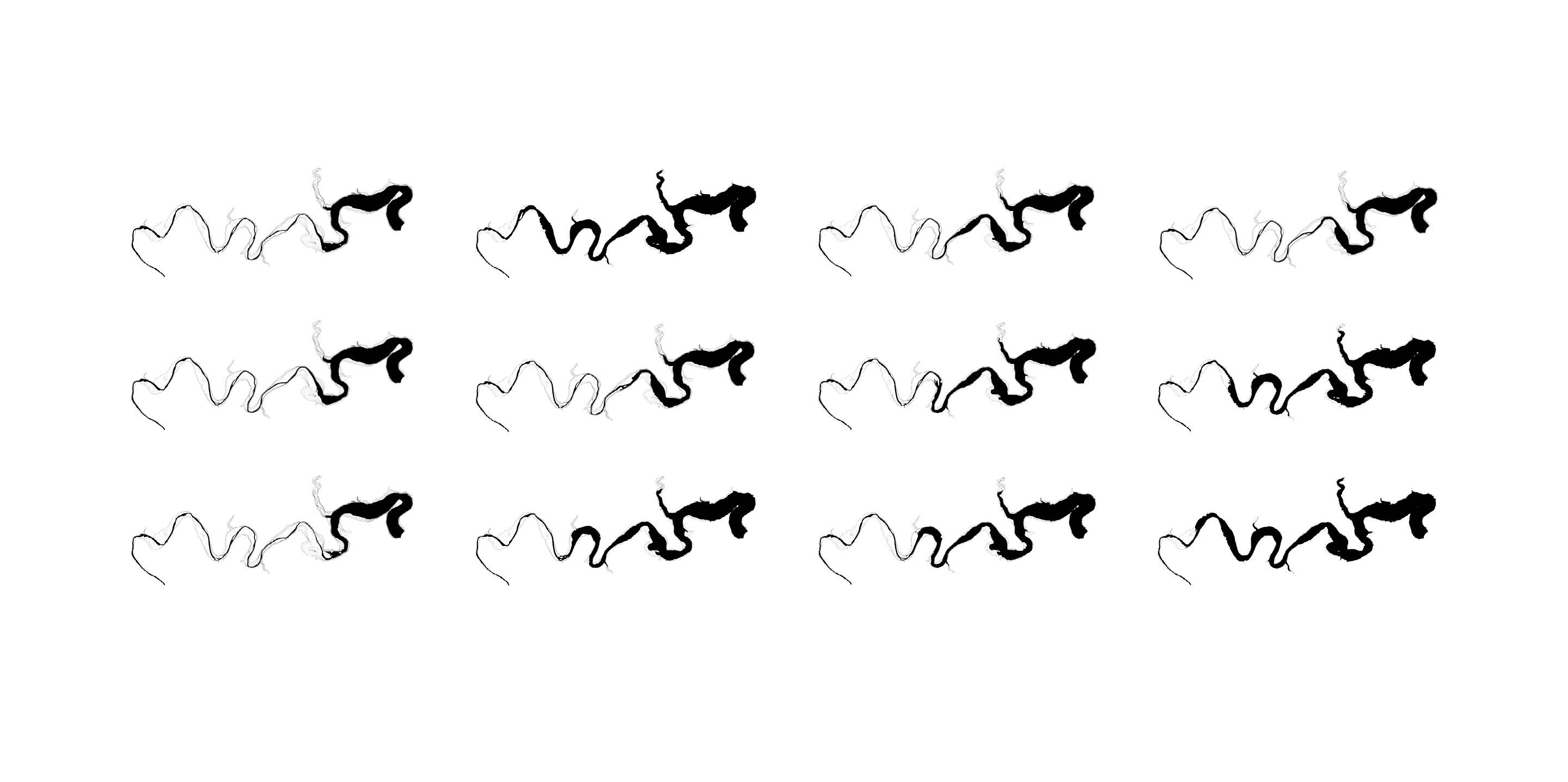
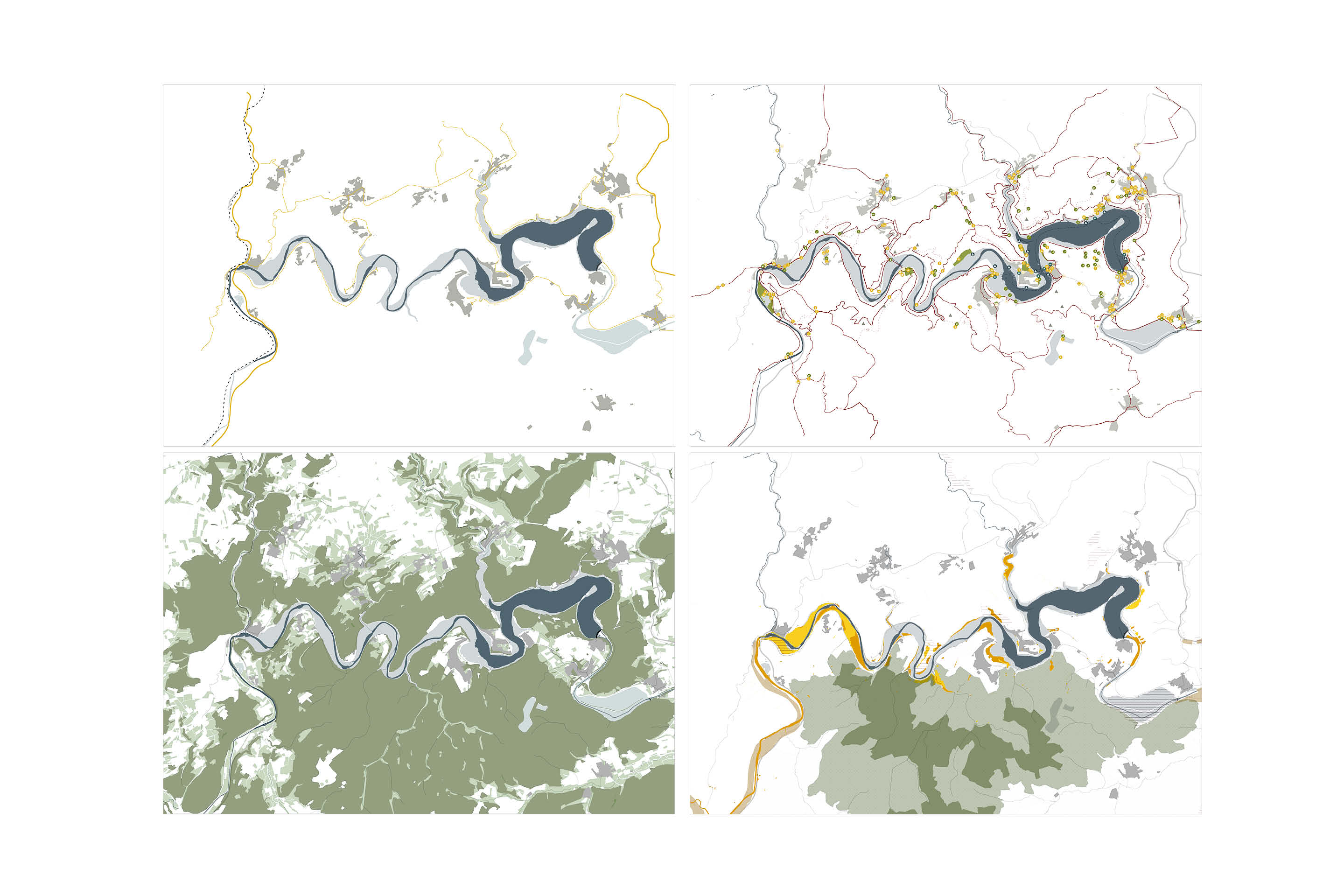
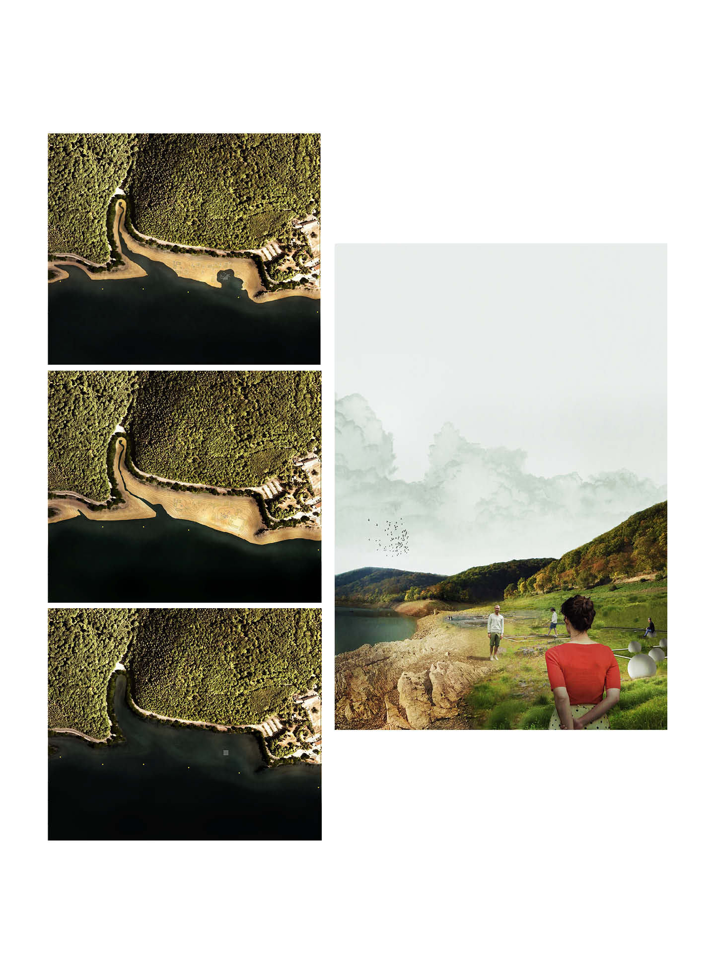
The Edersee, located in northern Hessen, is selected as an exemplary study because its water level was eminently low in the 2016/2017.The functional designation of Lake Edersee as a federal waterway is primarily the compensation of low water level increase to ensure that Upper Weser and the Mittelland Canal are navigable.
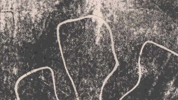
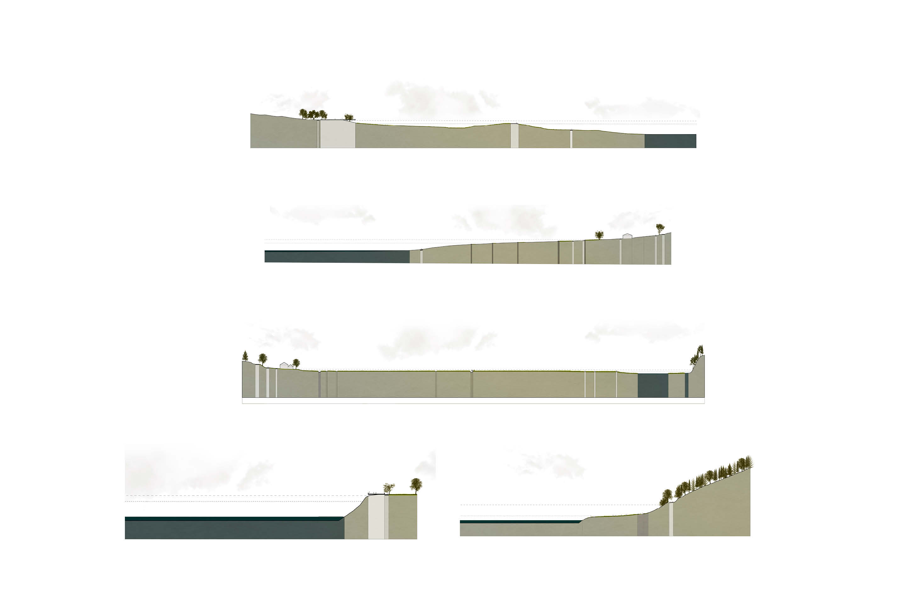
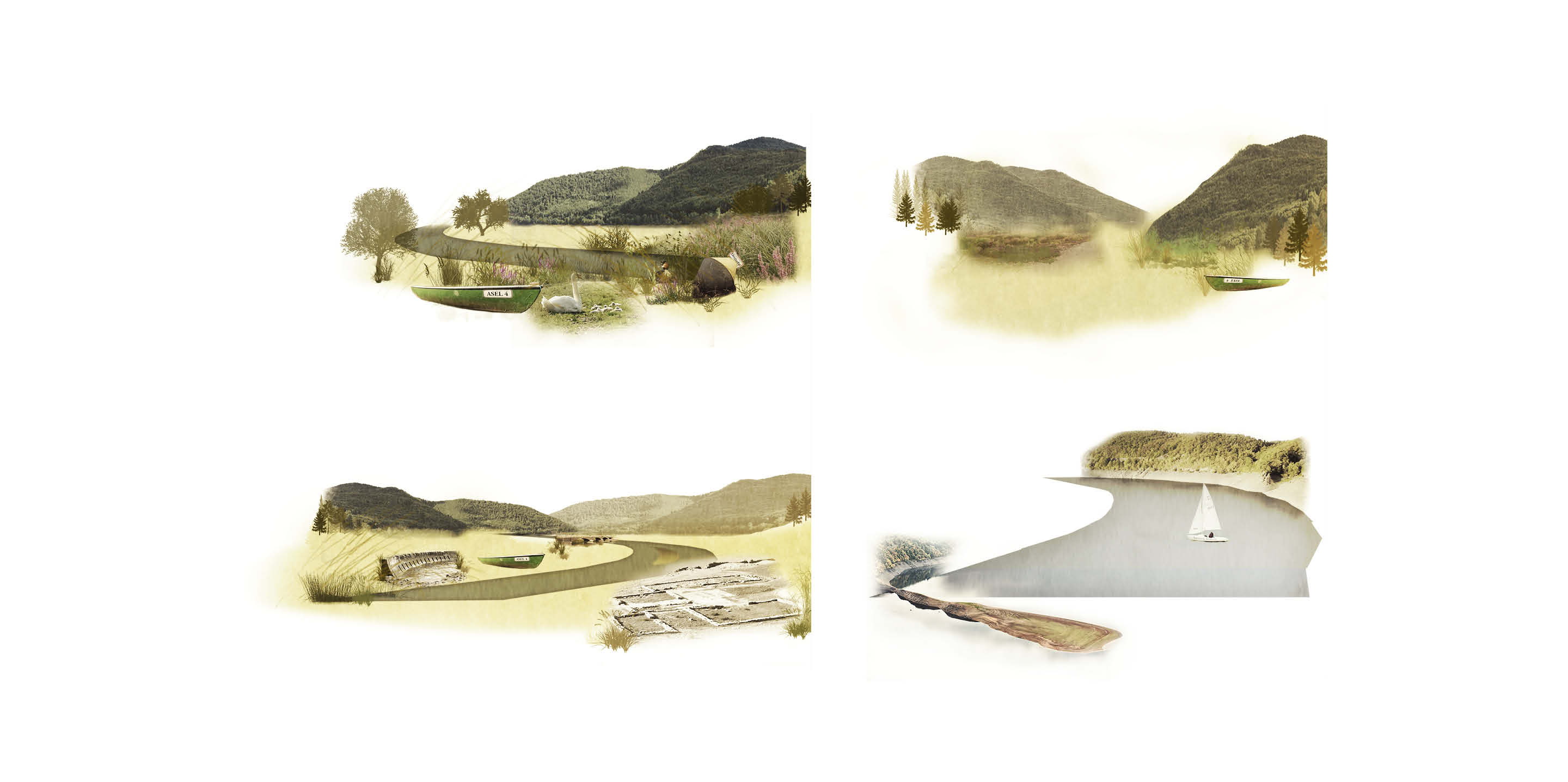
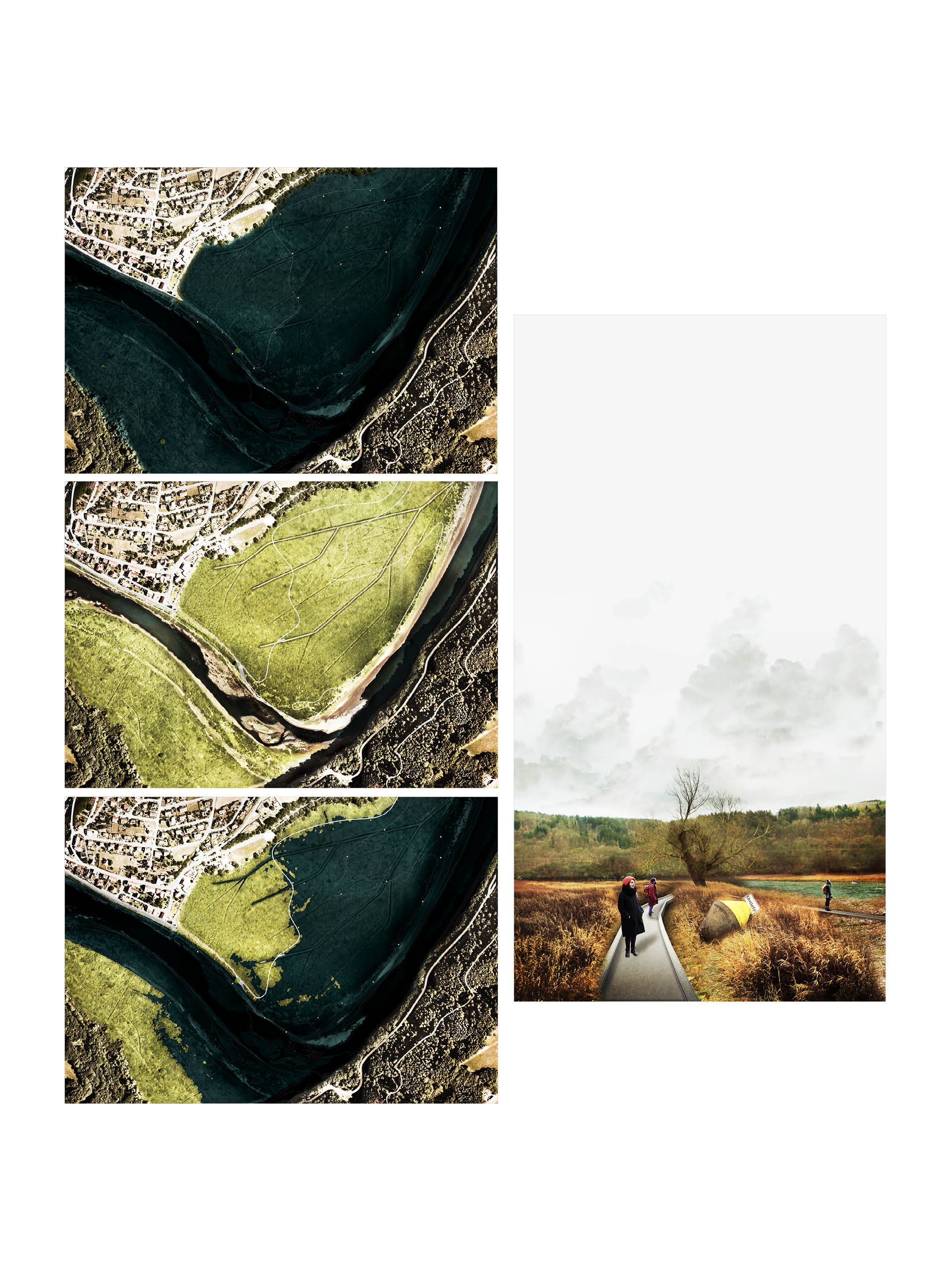
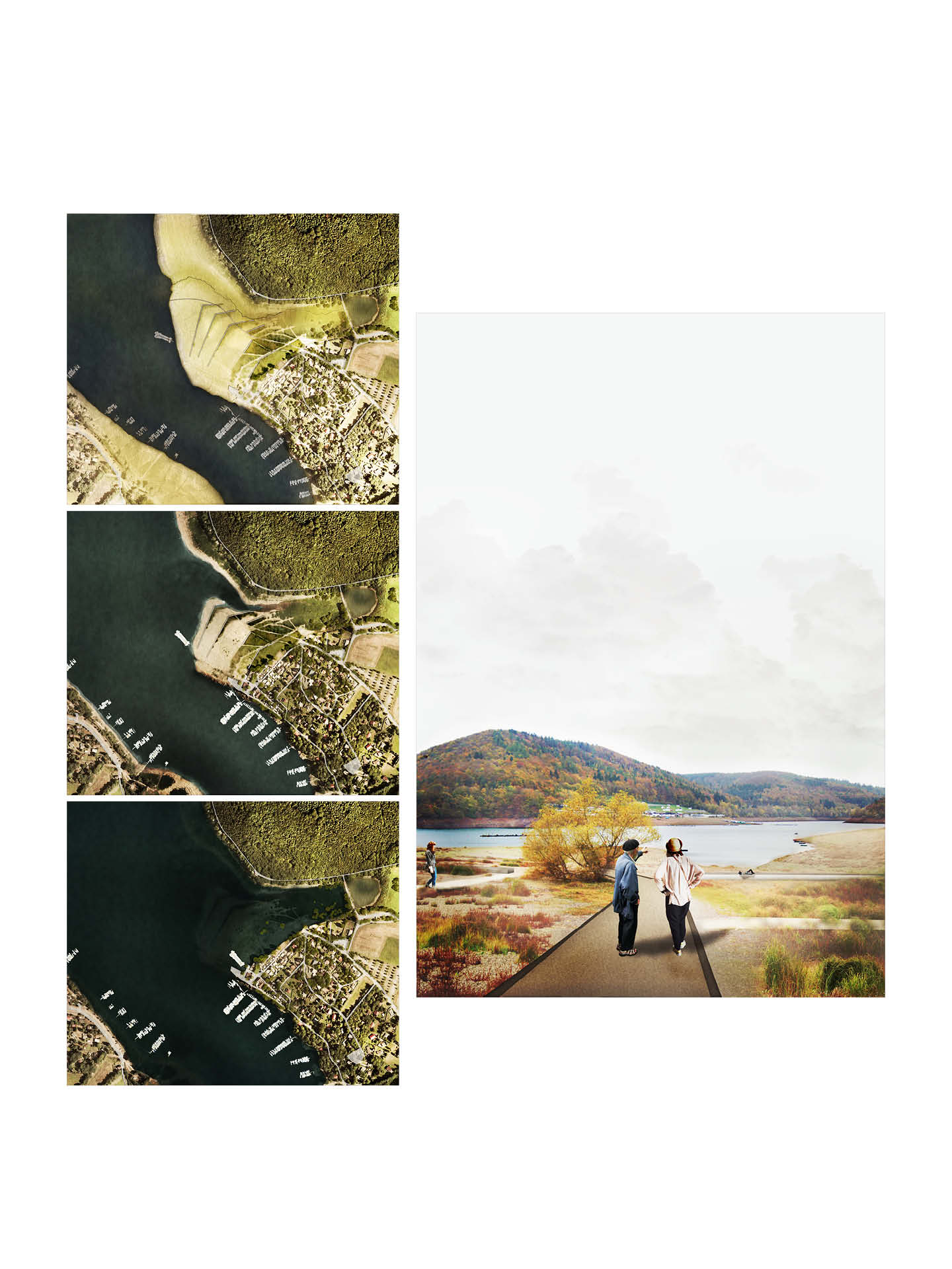
Moreover, over the past decades, the Eder dam has become increasingly important for tourism, particularly for water sports, so that the entire region is economically dependent on tourism. While low water levels have always occurred in the autumn months, the long dry periods in summer are an increasing problem for tourist destinations. The advertisement of the remaining village structures publishes the low water level as a `waste attraction´, which has a negative impact on the Edersee destination. The analytical approach examines the geographical and functional integration as well as the spatial effects of management in the form of fluctuating water levels, which may occur in close succession and at irregular intervals. A division into different bank typologies makes it possible to describe and understand the different atmospheres and qualities more precisely.
Different design situations in the study area will be used to test how a redesign can transform low water levels, which are regarded as a deficit, more attractive. Sensitive landscape architectural interventions highlight the unique qualities of the low water levels and arrange them in a new way so that they are made accessible to the visitor. For this purpose, not only the existing structures of the former uses are taken up, but relations between the different worlds, that of the reservoir and that of the lake bed, are repeatedly established. The design, which is specially adapted to the conditions of Lake Edersee, reveals commonalities which can be formulated as transferable strategies when viewed as a whole. In the end, a series of strategies will be developed which react to the different characteristics of low water levels and can be used as a study basis for fluctuating water levels at dams or dams in general.
| Author/s | Kerstin Wagener |
| Phase | Thesis |
| Location | Edersee Hessen |
| Categories | Landscape, Waterfront, Thesis |


